Started the day off by stopping by the office to look over data. There are some things I just can't get easy access to on-line and using my unnamed employer's system makes diagnosing the atmosphere that much easier. Late morning indications were to head north into the Texas Panhandle which was my initial target area. Swinging over to my friends A&N house to pick them up, we started to fiddle with my laptop and Blackberry tether connection. This stupid thing would never connect and we spent about 45 minutes in Plainview, TX trying to get the darn thing to work.
Finally, A mentioned that the local book/music/movie store had free wi-fi so we trucked down the road to get the latest data. While doing so, we could see towers starting to build off to the east. A quick call back to the office also confirmed what we were seeing; new towers were popping up out east of Lubbock while special soundings in Amarillo and by the VORTEX-2 crew showed there was a stout cap in place over the Panhandle area. Our only play now was to head east and see if we could get in a good position on the rapidly developing storms. As the laptop/Blackberry combo wasn't working, I once again had to solely rely on RadarScope on N's iPhone which is an important thing to remember later on in this post.
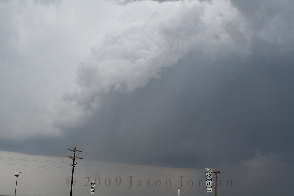
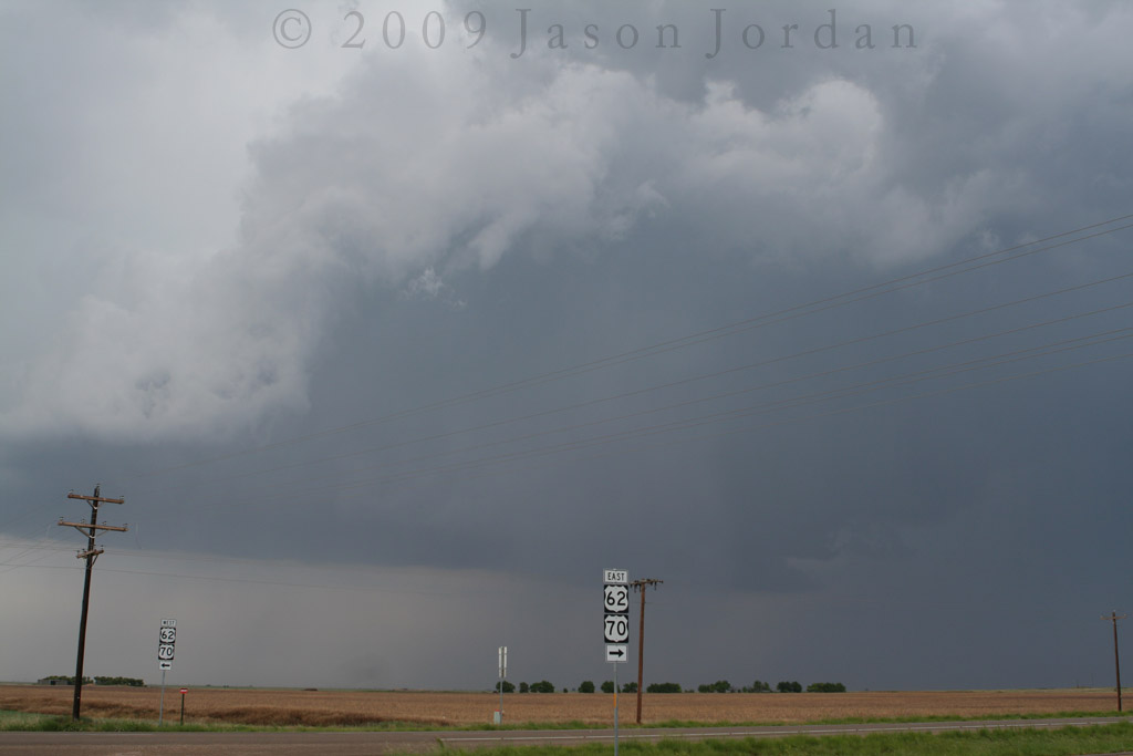
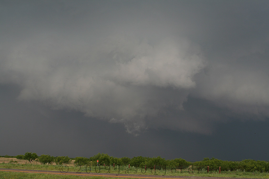
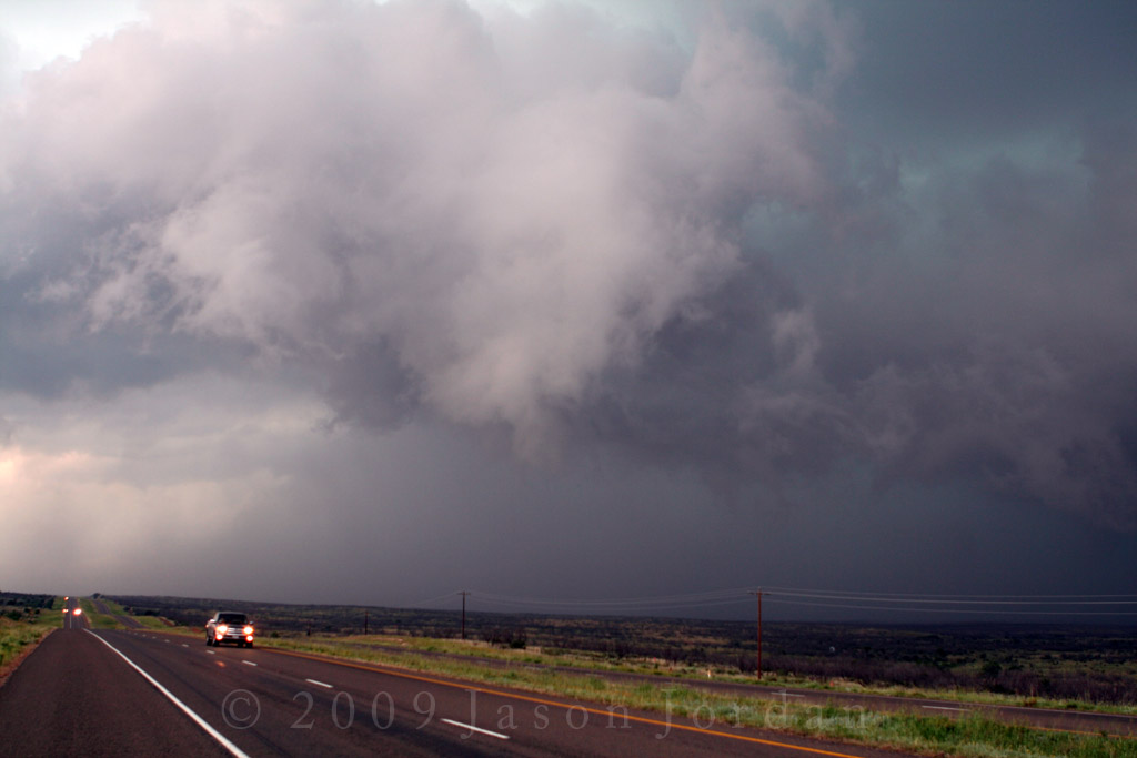
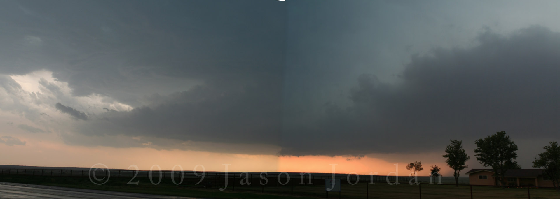
Heading out US 70 from Plainview, we entered into Floydada and tried to figure out the best way to get into position. Unfortunately, my map was not quite clear enough and we started heading south and west as opposed to continuing east. This was sort of fortuitous because by the time we got turned around and in position, the biggest storm in the area had started to split and we were able to look at both storms (storms split due to a somewhat straight-line hodograph). Stopping east of town at the intersection of US 62/70 & FM 651, we saw this:
Backside of the left split with RFD wrapping around, 3:23 PM CDT
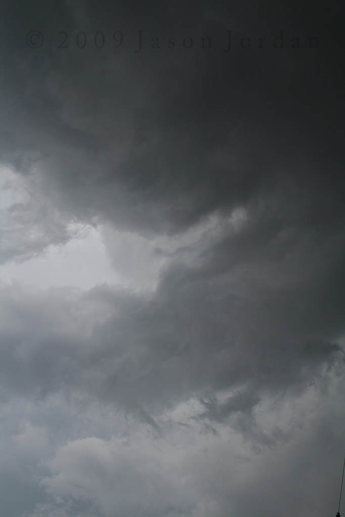
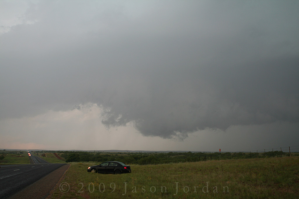
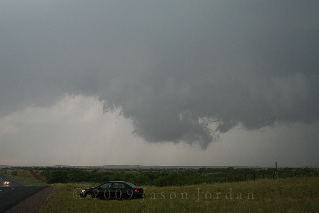
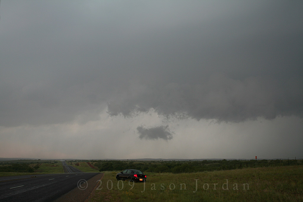
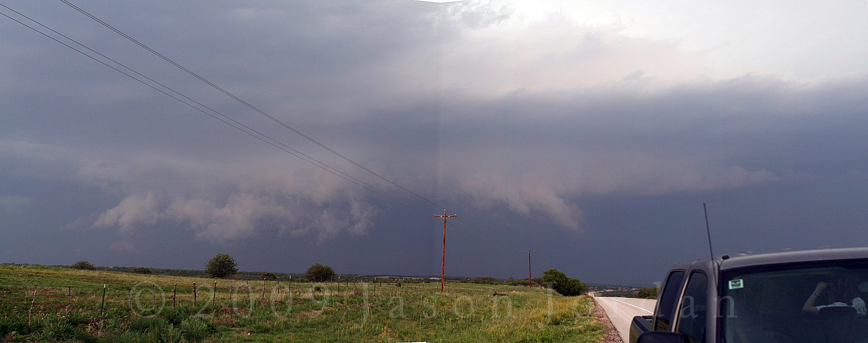
We continued to sit at this intersection and watch the RFD try to spin up a meso on the left-split member but it became clear we were not going to see much. HOWEVER, it did give us one glimpse of things to come, producing a weak mid-level funnel:
Funnel is slightly above and left of center, 3:24 PM CDT
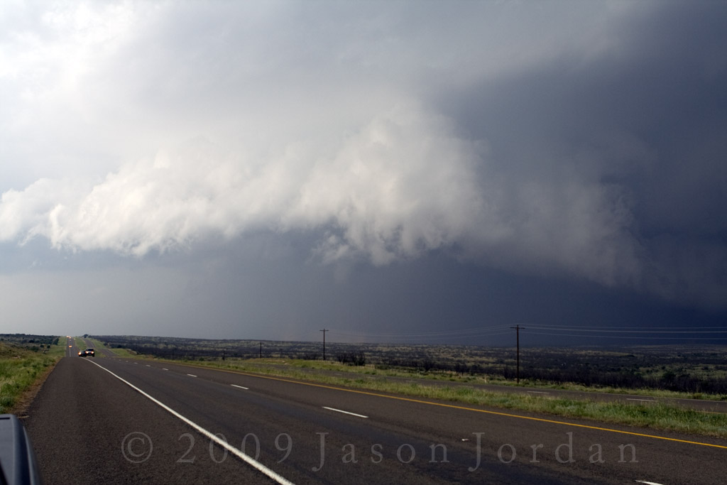
By this time, the right-mover was starting to move away from us to the southeast and we needed to reposition. Unfortunately, the RFD had cut off our best option on FM1958 to Roaring Springs, so we had to backtrack down FM 651 to FM 193 and then head east. As we headed east out of McAdoo and off the edge of the Caprock, the storm was belching large amounts of warm RFD resulting in quite a bit of dust being kicked up. We passed through a wind farm surrounded by gustnadoes of various sizes and shapes and finally made it to the intersection of FM193 and TX70, just west of Afton. A couple of other South Plains Storm Spotting Team members had finally gotten ahead of the storm and were in East Afton looking at things as well. Looking of to our east, we could see a wall cloud with broad rotation. The other spotters could see the same thing, and they were looking west. In my mind, we were seeing the same thing until they said they had possible funnel cloud developing when I couldn't see that. A few frantic messages later, A leaned over and said I had better take a look out the drivers window:
Developing funnel is O V E R us! 4:10 PM CDT
A got this series of pictures looking out the passenger rear of my pick-up:


Needless to say, we had to bail south in a hurry and made it down to Dickens on TX70 in a HURRY. The only option from there was to head east on US82 as the storm had started to move more east than southeast. We made it somewhere east of the intersection of FM2941 and US82 and sat up on top of a hill watching the storm move towards us. Although a wall cloud had wrapped up back in the notch of this HP storm, a new wall cloud tried to develop on the leading edge and started to look good.
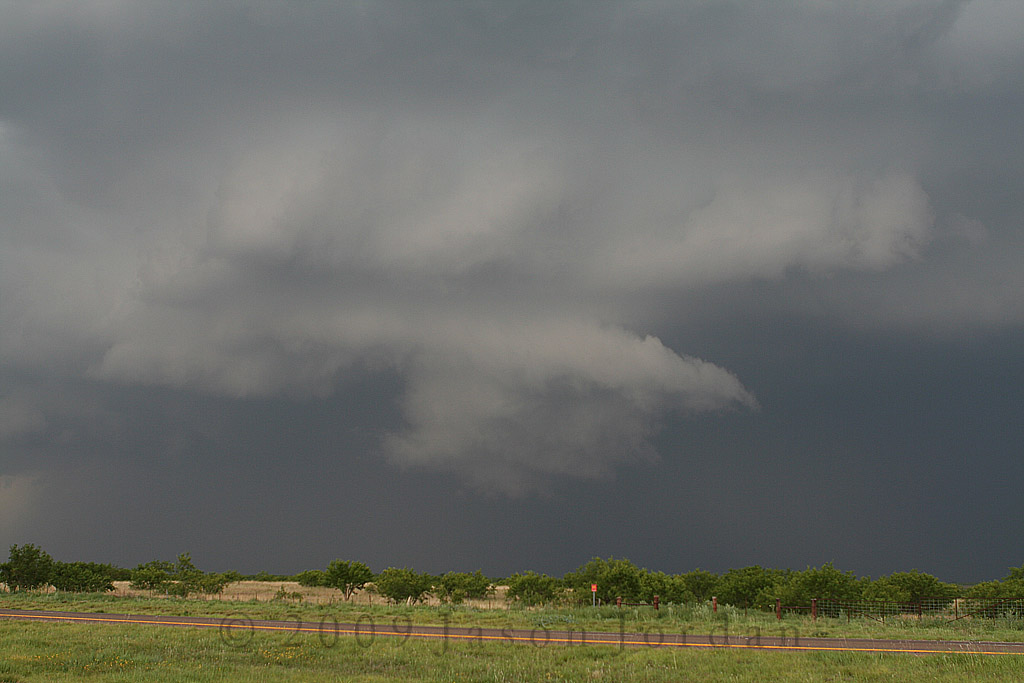
New wall cloud developing northwest of our location, 4:29:03 PM CDT
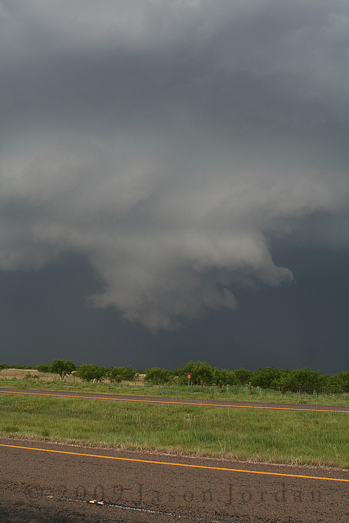
Wall cloud continues to lower and rotation slowly increases, 4:29:39 PM CDT
Unfortunately, the RFD was still ruling the storm and the wall cloud quickly became undercut by outflow and the rotation sheared out right in front of us.
Wall cloud starts to fall apart, 4:32 PM CDT
Although the RFD had undercut this wall cloud, a new one started to form to the south of the RFD punch where a new updraft was developing. Based on spotter reports from my friends, I'm guessing that this next picture was looking north of the end of FM2941 to our west northwest by quite a few miles...
Is it a tornado or is it not? 4:38 PM CDT
Taking a closer look, zoomed in to the area of interest at native resolution:
Is it a tornado or is it not? 4:38 PM CDT
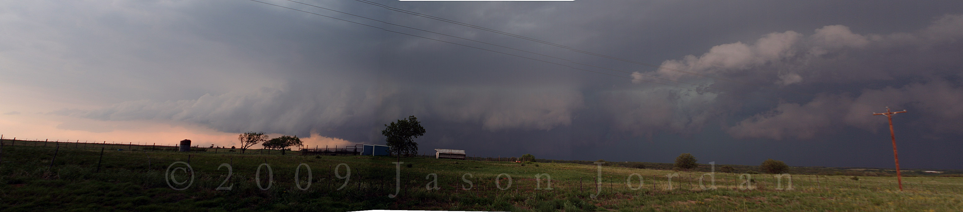
The funnel dissipated around 4:39 as another RFD surge hit the storm but we continued to watch the area of rotation rotate around back into the notch. The storm looked like this by that time:
Panoramic at 4:40 pm CDT, possible wall cloud in the notch to our northwest.
By this time, several things started to happen. The number of chasers started to increase in our area from both the west and the east. Earlier on up at Floydada, I knew of only 2 other people on the storm and all of us were spotters based out of the Hub City. Now there were probably about 20 vehicles on the storm which caused problems with finding the few places to pull off between Dickens and Guthrie. The second thing was a second storm had started to develop south of this one and we were now getting precipitation where we were located. This wasn't good because the chances for lightning and large hail were increasing. Finally, RadarScope showed the storm would move south with an RFD surge than back to the east as the meso would redevelop and strengthen. Visually we could see this as the RFD gust front rapidly approached from the west...
Here comes the gust front, with some rotation along the leading edge. 4:42 PM CDT.
We piled back into the pick-up and started heading east into King County and stopped a mile or two inside the county line. Sure enough, a new wall cloud was trying to form on the northeastern edge of the RFD surge:
New Wall cloud with weak rotation, 4:55:59 PM CDT
A funnel tried to form on the north/northeast side:
New Wall cloud with weak rotation, 4:56:27 PM CDT
But the wall cloud started to be undercut by outflow once again and the rotation totally dissipated:
It is almost gone. 4:57:36 PM CDT
As the storm continued to approach, we started to head into Guthrie. One of the spotters called in with reports of another wall cloud possibly back in the notch and we stopped across from the 6666 Ranch headquarters. By now, a southern storm had started to interact with the main storm and we had finally gotten out from under the precipitation from the anvil of the second storm.
New updraft area developing west of Guthrie, looking west. 5:09 PM CDT
Opting to continue south to try and to keep even with the area most likely to develop a wall cloud, we took the new bypass around Guthrie and stopped for a bit to look over radar data at the US82/US83 split on the south side of town. The loop on RadarScope confirmed that the storm was starting to move southeast and we had a chance to stay parallel with it on US 83. Continuing south, we headed down into the Salt Fork of the Brazos River basin and got caught at the bridge which was under construction and down to one lane. We got through the light and crested the other side of the valley to hear one of the spotters behind us reporting that something possibly had wrapped up in the notch again. Unfortunately we couldn't see anything as we had ended up quite a ways south of the area of interest:
Looking back towards Guthrie to our North. 5:42 PM CDT
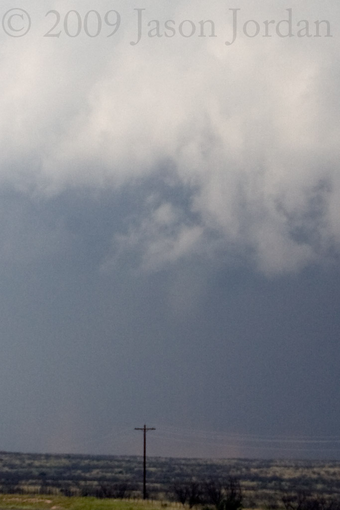
The reports of a possible lowering and funnel cloud continued to come in and we could barely make something off in the distance:
All we could see was some low hanging clouds. 5:44 PM CDT
Enhancing the image reveals this (but not much better than before):
Same image as above, contrast and brightness adjusted.
I didn't know what to think. However, the area we were concerned with off to our west was starting to try to spin up a new wall cloud as well. Although it was being pushed southward by more RFD, we did see this area start to develop:
Somewhere 5-10 miles north of Aspermont, 5:47 PM CDT.
We continued to watch it with 5 sets of eyes and the area started to show some better rotation with a few small funnels trying to develop along the leading edge.
5:50 PM CDT.
This was an impressive storm! Unfortunately it had turned into a massive HP monster and you had to be in the right place at the right time to see anything. Unfortunately, the road networks in this area wouldn't allow that...
5:51 PM CDT.
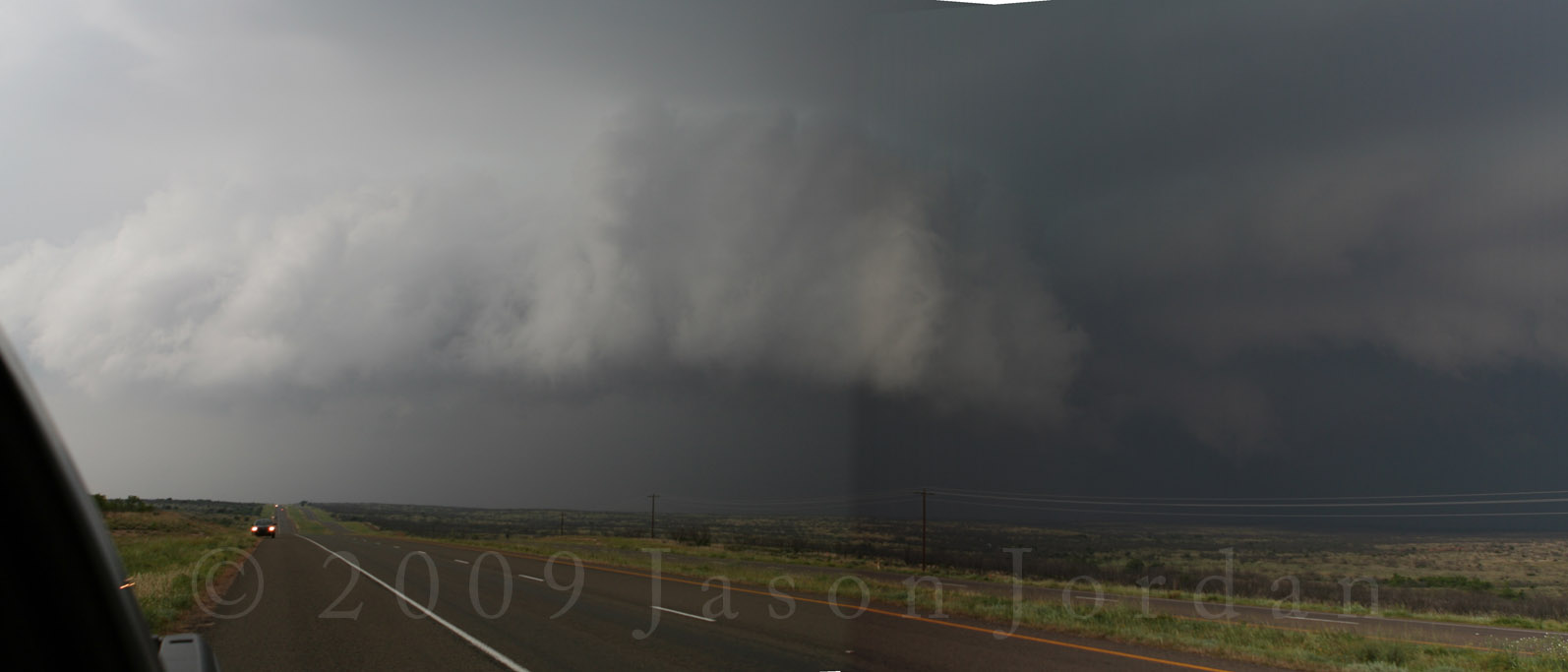
Based on the way the radar looked, we decided to head down into Aspermont and figure where we should go. We knew we were in a bad spot because the storm looked like this:
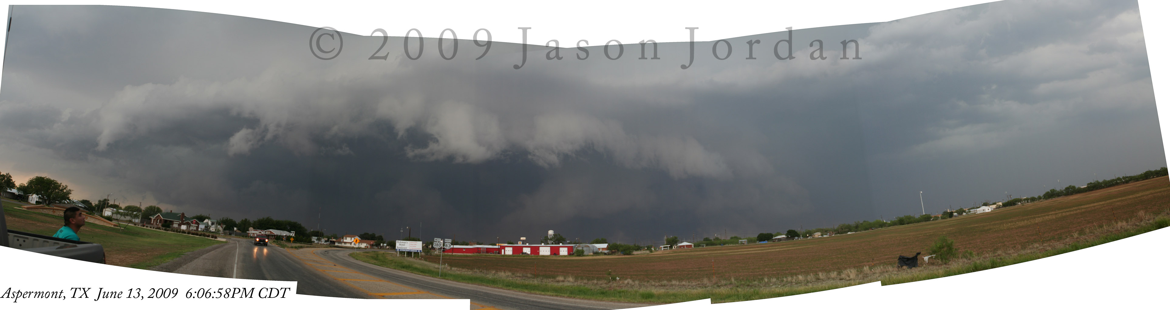
Taken on the south side of Aspermont at 6:07 PM CDT.
RadarScope also showed that there was a good storm heading towards Silverton that would be our only play unless we wanted to follow this all the way to Abilene. I didn't want to do that as I had to be up early Sunday morning to play electric guitar at church. My plan was to head west on FM 2211 out of Aspermont and skirt around the west side of the storm/RFD. However, this plan was an epic failure.
Driving north through Aspermont, we hit the outflow head-on. Dust reduced visibility to zero and I missed the road sign for FM 2211. By now, the locals had taken shelter in all available spaces and those that weren't occupied were of questionable construction. My second bad choice was that it looked on RadarScope and my maps that we would be able to skirt south of the high reflectivity core on US380 since we were already at the US83 split. About this time, we started to encounter winds that I estimated to be 60-70 MPH with gusts approaching 80. We were in zero visibility, not from dust but blinding rain and occasional leaf debris falling from the sky. I couldn't raise the spotter in front of me or anyone else on the radio and we continued to go westbound. Right before Swenson, the wind was blowing so hard that I could feel the rear of the pickup occasionally slide sideways, we were pushed into the oncoming lane of traffic (with NO traffic thank goodness!), and the windshield wipers were lifted off the windshield and I couldn't see. There were also occasional periods where tree branches were breaking off and landing in the road. Calling back to the home base, I informed the office what was going on and we pushed through the storm.
Finally, about 10 miles from the county line, we broke out of the rain although the wind was still rather high. I called back to the office to report some power lines down since my ham radio wasn't working and this was when I was informed that the West Texas Mesonet station at Aspermont hit a gust of 100 MPH with a possible tornado passing over the station.
Best I can tell was that we were probably about 5 to 7 miles east of the tornadic circulation and caught in the core of the RFD. Fortunately for us there wasn't any hail involved. We finally stopped in Spur for a much needed bathroom break and opted to try for Silverton. Pulling into Dickens however, that storm had already started to weaken and we opted to grab some BBQ at the Ponderosa Cafe. After refueling our bodies with the delectable goodness of that BBQ, the drive back to Lubbock was quite somber; I nearly screwed the pooch on this chase big time.
So what went wrong?
My first mistake was using and trusting poor resolution radar data on a small iPhone screen and trying to mentally overlay the roads out of my Texas Atlas and Gazetteer. From the pure reflectivity view, we should have had no problems driving north of Aspermont and then west. What I failed to do was keep the big picture in mind and remember that the RFD would surge south. We likely drove right through one of those surges right as it hit the ground (which matches up nicely with radar data). Would I have made a different decision if I had GRLevel3 up and running with a road overlay, who knows? A good chaser wouldn't need technology when under the storm because training, knowledge, and experience would have been enough. Perhaps it is time to ditch the technology and go "old school" as I do at work every morning...
The second mistake was losing sight of the big picture north of Dickens. When we drove off the caprock, we were under a lot of towering cu; likely the flanking line of the storm. Unfortunately all the dust and winding roads kept me from looking up; I had to keep my eyes on the road the whole time and then out the drivers window to make sure nothing was coming at me in the strong crosswinds. The WHOLE sky should have been the first thing I surveyed, not RadarScope.
Thirdly, I've had two close encounters with HP storms and this makes the third. After those first two times, I thought I learned my lesson. The lesson is never to drive straight towards an HP storm if it is coming at you at 40 mph. Imagine the game of Pac Man, being a dot in his mouth as it is closing moving towards the right side of the screen, and that is what the situations were like the first two times. Somehow, after 10+ years, that lesson was forgotten and I opted to go against my better judgement and try to outmaneuver a storm. I got to close and nearly paid the price.
I was lucky. Lucky that I didn't get pounded by large hail. Lucky that I didn't have tree limbs fly through the windshield or windows. Lucky my friends weren't hurt. To A&N, my apologies for getting into those spots. N, you learned an invaluable lesson by my mistake; remember it and you will do well as you start your spotting "career".
I'll still chase, but this was a dang good reminder that without the proper respect, Mother Nature will use storms to bite you in the a$$ if you aren't careful...